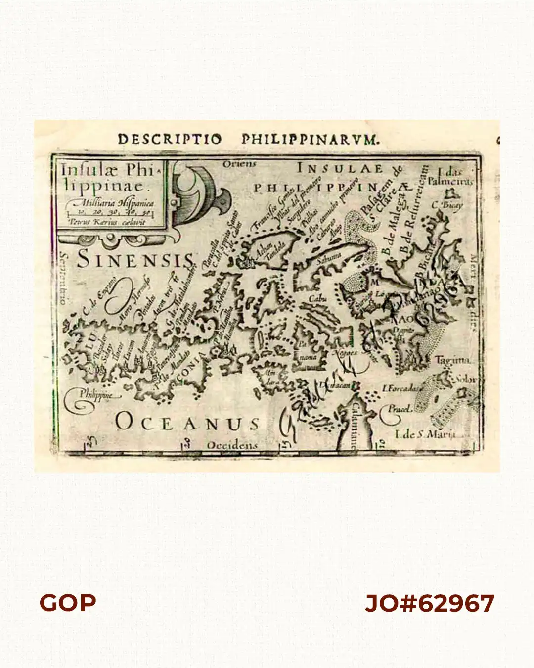
Description
copper engraving. verso: Latin text “Descriptio Philippinarum” p. 616.
EXTREMELY RARE map from Barent Langenes & Cornelis Claesz: ‘Caert Thresoor’ in Amsterdam but Latin edition by Petrus Bertius “Tabulae Geographicae contractae (Miniature World Atlas); chapter: ‘Descriptio Philippinarum’; pp. 615 – 616. THIS IS THE FIRST MAP SOLELY SHOWING THE PHILIPPINES (1598). Essentially taken from Plancius’ “spice map” “Insulae Moluccae …” of 1592, and van Linschoten’s “Exacta & accurata delineatio cum oranum maritimarum…” of 1595. It helped to define “The Philippines” as ONE country.
Kaerius (Pieter van den Keere) was one of many refugees who fled from religious persecution in the Low Countries (Netherlands, etc.) between 1570-1590. He moved to London with his sister, who married Jodocus Hondius, the famous cartographer, from whom Kaerius must have learned his skills as an engraver & cartographer. Koeman distinguishes two atlases: The Caert-thresoor, published by Langenes and Claesz., with 5 editions from 1598-1609; and the Tabularum Geographicarum Contractarum by Petrus Bertius with 10 editions from 1600-1650.

![Plan du Port de Subec, en I'Isle de Lucon [Plan of The Port of Subic on Luzon Island]](https://www.gop.com.ph/wp-content/uploads/2015/05/JO55439-de-Mannevillete-c1775-Plan-du-Port-de-Subec-600x750.webp)