Description
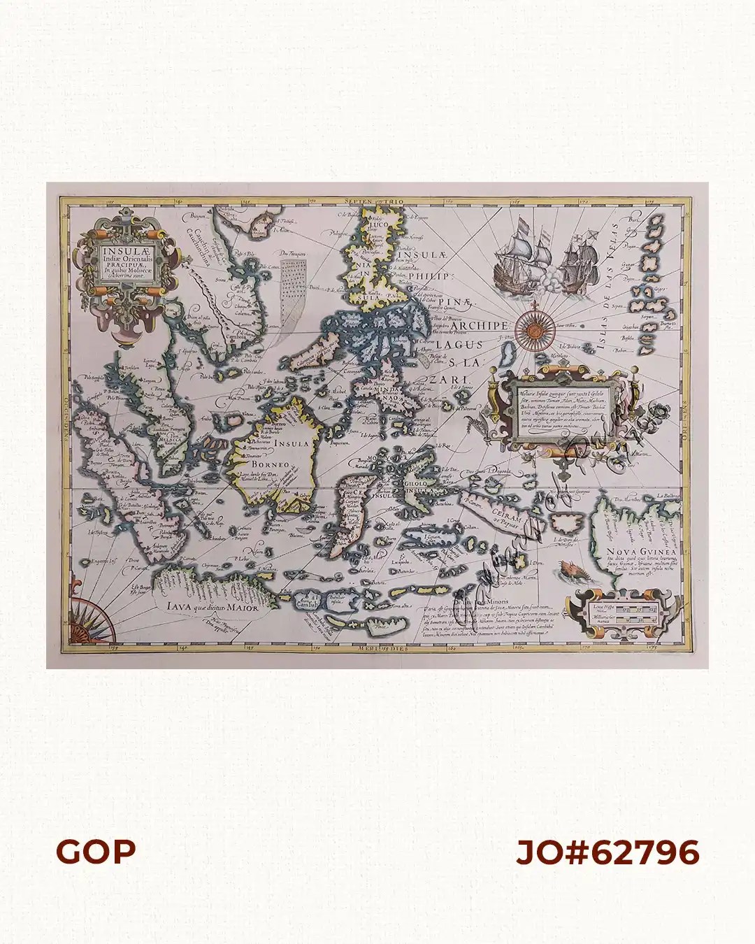
old hand-colour copper engraving. verso: text “Les Isles Moluques…”.
EXTREMELY RARE map from ‘L’Appendice de l’Atlas De Gerard Mercator et Iudocus Hondius …’, pp. 677/ 680, ornamental strap-work title-cartouche with explanatory notes, a second ornamental cartouche with the map scale, two ships, two compass-roses, rhumb-lines and a sea monster. French edition. Early 1600s, upon his return to Holland, Hondius bought Mercator’s plates, adding 36 of his own to reissue the ‘Atlas’. This particular map is one of the most colourful ever printed of the East Indies. A Spanish and a Dutch war ship battle each other at the top right corner, based on the battle between Admiral van Noort and Antonio de Morga in Dec. 1600 off Manila Bay. Hondius notes on the map the important event of Francis Drake making landfall in Southern Java, being the first European to do so.


