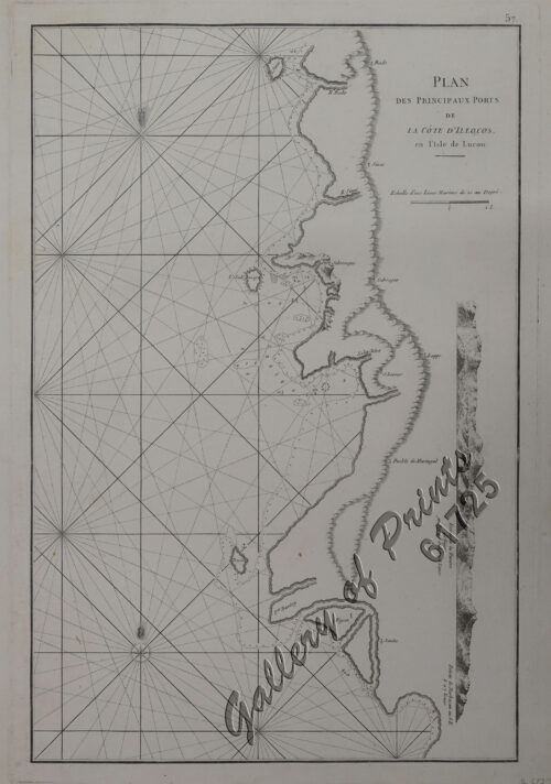
Author: Jacques Nicolas Bellin
Publisher: Didot in Paris.
Year: 1748
Size: 28.7 x 29.7 cm
Reference: not in Quirino
₱46,600.00
In Stock
In Stock
copper engraving.
RARE German edition of Histoire Generale des Voyages, volume 3. Zusatz zum 1. Bande 4e Karte [supplement to vol 1, map 4]. Nicolas Bellin (1703-1772) was one of the most important and proficient French cartographers of the mid-eighteenth century. He was appointed the first Ingenieur Hydrographe de la Marine, and also Official Hydrographer to the French king. Bellin produced a substantial number of important separately issued maps, particularly reflecting continuing discoveries and political events in the Americas.
with fold as issued.