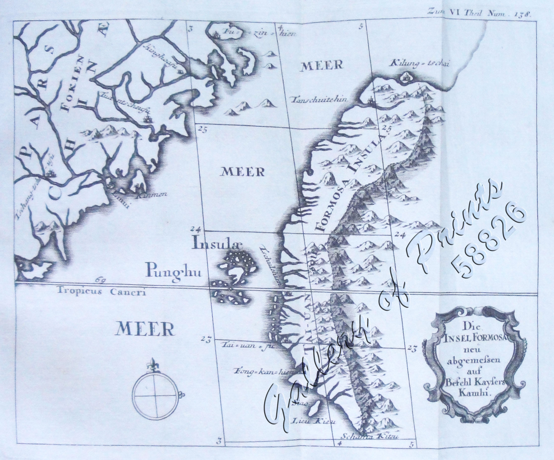
Die Insel Formosa neu abgemessen auf Befehl Kaysers Kamhi. [The Island of Formosa As Newly Surveyed By Order of Emperor Kamhi]
₱49,500.00
In Stock
In Stock
Description
copper engraving.
EXTREMELY RARE map showing the western part of Taiwan, its coastlines with the the Punghu or Pescadore Islands and the mainland coast of Fukien depicting Keelung, Tainan, and probably Kaohsiung. Like most early maps of Taiwan, only the West of the Zhongyang or Chungyang Range shows some detail; other areas remain vague and undefined, reflecting the lack of topographical knowledge then; from the first edition of “Der Neue Welt-Bott… ” [The New World Herald…] [Jesuit letters]… “Allerhand So Lehr-als Geist-reiche Brief, Schrifften, und Reis-Beschreibungen…”; published by Philipp, Veith Martin & Johann Erben, Buchhaendler in Augsburg & Graetz between 1726 – 1761. Joseph Stöcklein (1676-1733), an Austrian Jesuit, started work on the above summary in 1724, compiling and translating missionary letters from the 34-volume French Jesuit Lettres edifiantes et curieuses, écrites des Missions étrangères…”, that appeared between 1702 and 1776. Two years later, the first volume was published in Augsburg and Graz in 1726. He received letters from German-speaking missionaries from all over the world, Stöcklein included many of them, added many detailed maps, and became responsible for a compendium, distinctly different from the hugely successful Lettres Edifiantes, and equally sought after.
Condition
with folds as issued, large paper edition, wide margins, excellent condition.

