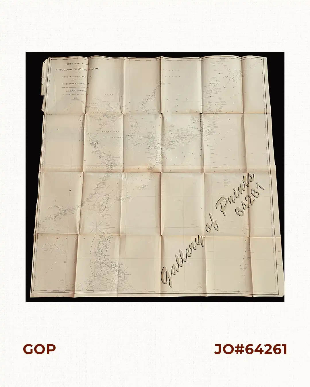
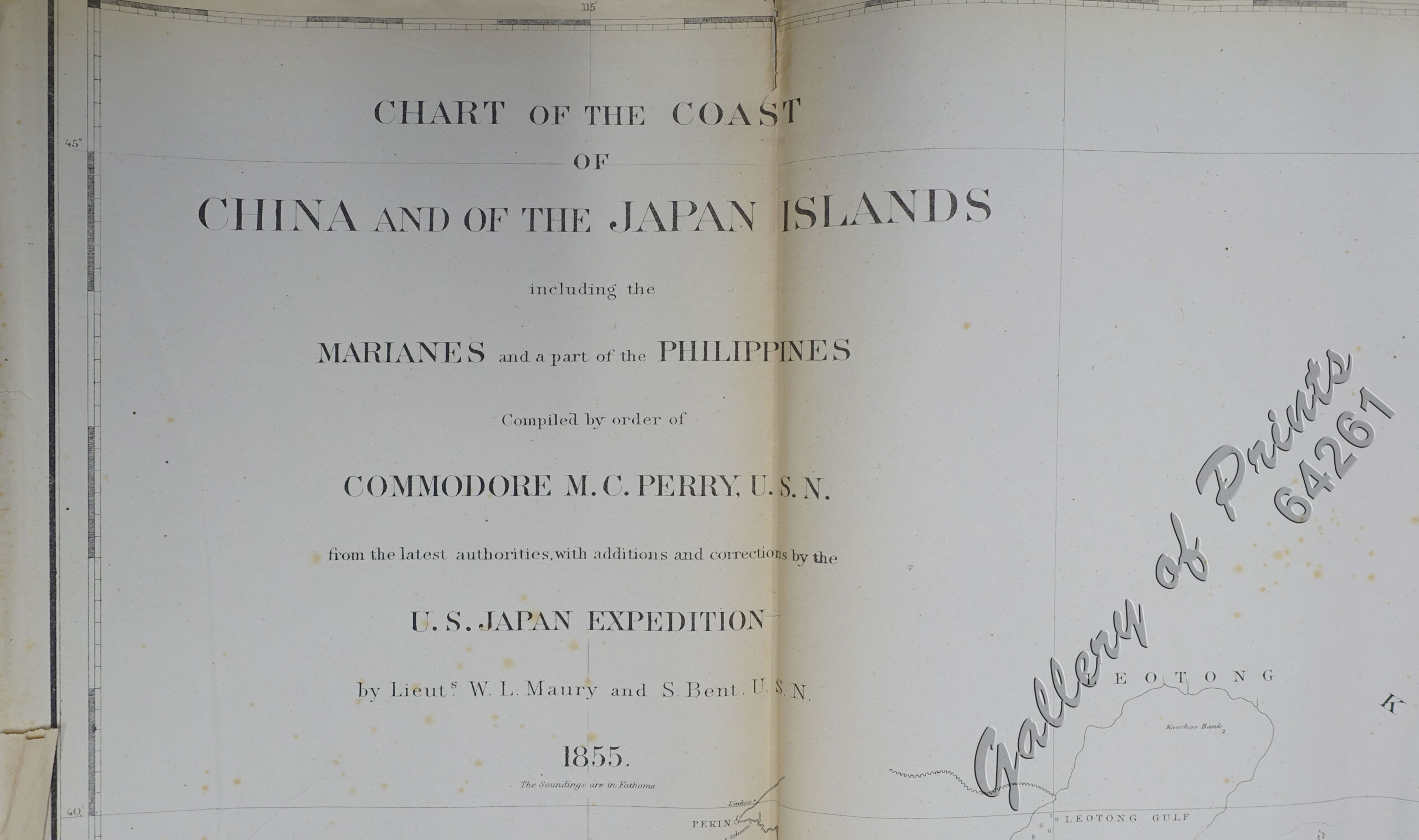
Description
lithograph seachart from ‘Narrative of the Expedition… Commodore M.C. Perry, U.S.N.
A visibly well-used seachart centered on the seas surrounding the Philippines.
₱39,600.00
Author: J. Bien [lith] / Edw. Sels [artist] / S[elmar] Siebert [engr]
Publisher: published in New York.
Year: 1855
Size: 108.3 x 104.2 cm
Reference: not in Quirino; Cordier 2122-23; Sabin 30968
1 in stock
lithograph seachart from ‘Narrative of the Expedition… Commodore M.C. Perry, U.S.N.
A visibly well-used seachart centered on the seas surrounding the Philippines.
folded as issued, with minor separation at a few folds, professionally repaired, cropped top and left paper edges.

![Islas de Infanta y Polillo pl. 12 [Quezon Prov., Polilio Is., Pananongan I., Jomalig I.]](https://www.gop.com.ph/wp-content/uploads/2023/08/JO62585-Algue-1900-Quezon-Province-Polilo-Jomalig-Patnanongan-scaled-1-600x750.webp)
