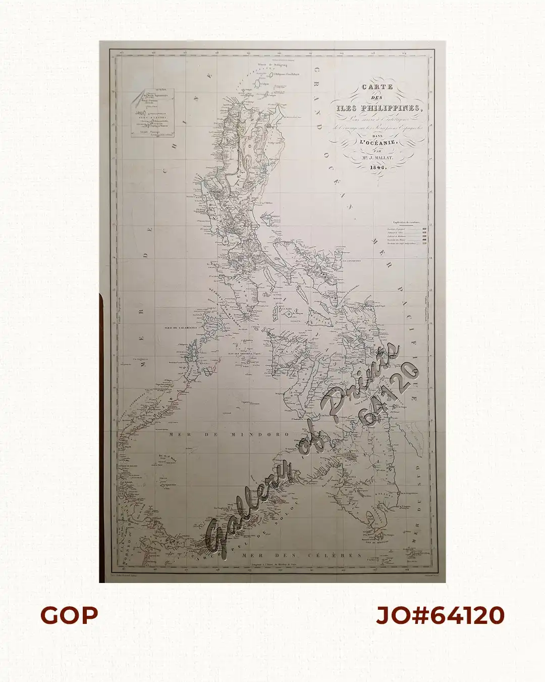
Description
original outline hand-colour steel engraving.
EXTREMELY RARE map from the Atlas (& album) of maps and hand coloured plates to a prime 19th century work on the Philippines “Les Philippines. Histoire, Géographie, Moeurs, Agriculture, Industrie et Commerce des Colonies Espagnoles dans l’Océanie.”, only edition. Born in the Nouvelle-Aquitaine region of southwestern France, Jean Mallat (1806-1863), became a doctor in Barcelona, and was subsequently appointed a physician at San Juan de Dios Hospital in Manila by the Spanish government. He would make three visits to the Philippines between 1838 and the publication of the present work. In 1844, he was named the Agent for Colonial France for the Indo-China seas and took part in the French possession of Basilan Island. In recognition of his participation, the Emperor granted him the addition of this island’s name to his family name: Jean Mallat de Bassilan [sic].