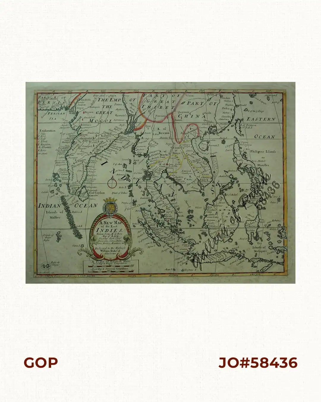
A New Map of the East Indies, Taken from Mr. de Fer’s Map of Asia, Shewing their Chief Divisions, Cities, Towns, Ports, Rivers, Mountains & c. Dedicated to His Highness William Duke of Glocester.

49,500.00

In Stock

In Stock

Author: Edgar Wells / Sutton Nicholls

Publisher:

Year: c.1704

Size: 35.8 x 48.5 cm

Reference: Phillips Atlases 564; Quirino, p.88
SKU: 58436 Category:

Description

hand-coloured copper engraving map from ‘Atlas of Ancient and Present Geography’.

Edward Wells was a teacher of geography at Oxford University. The map is dedicated to his Highness William, Duke of Gloucester, heir to the throne, who began his studies at Oxford in 1700 at the age of 11. He died at the age of 13, right after this map was created.

Condition

with centerfold as issued, light paper toning, foxed in lower half, paper creases along centerfold, cleaned.

Shopping Cart
There are no products in the cart!
Continue Shopping
0