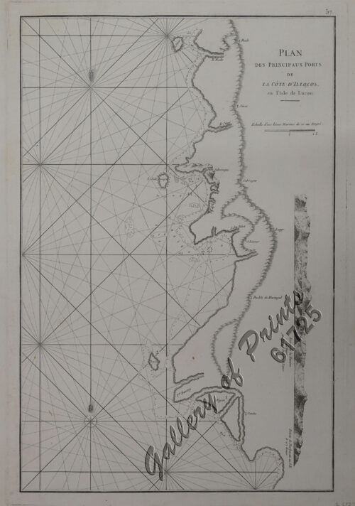
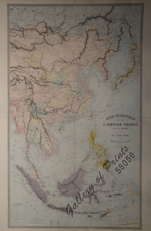
Author: Nathaniel Cutler / Edmond Halley
Publisher: J. & J. Knapton, W. & J. Innys, London
Year: 1728
Size: 1) 49.6 x 59 cm; 2) 49.7 x 58.8 cm
Reference:
₱155,000.00
In Stock
In Stock
hand-coloured copper engravings.
EXTREMELY RARE, a very special and difficult to find maps from Atlas Maritimus & Commercialis: or, a General View of the World for J. & J. Knapton, W. & J. Innys, London. The chart specially features the Philippines. The Atlas Maritimus can be used as an index of English trading activity at this period, since detailed insets and harbour plans emphasize those areas of greatest commercial significance. Although the author of the text is anonymous, Daniel Defoe is thought to have contributed to it, and Halley, the Astronomer-Royal, added a prefatory note discussing the use of the charts; it is therefore sometimes catalogued under his name. It has also been attributed to Harris, Senex, and Wilson, whose name appears on one chart. John Senex was certainly responsible for one of the atlas’s innovations, the globular chart of Western Europe whose projection according to the title-page was “authorized by letters patent”. The atlas was purely commercial and was not a real rival to the ‘English Pilot’.
with centerfold as issued.