Description
copper engraving. EXTREMELY RARE
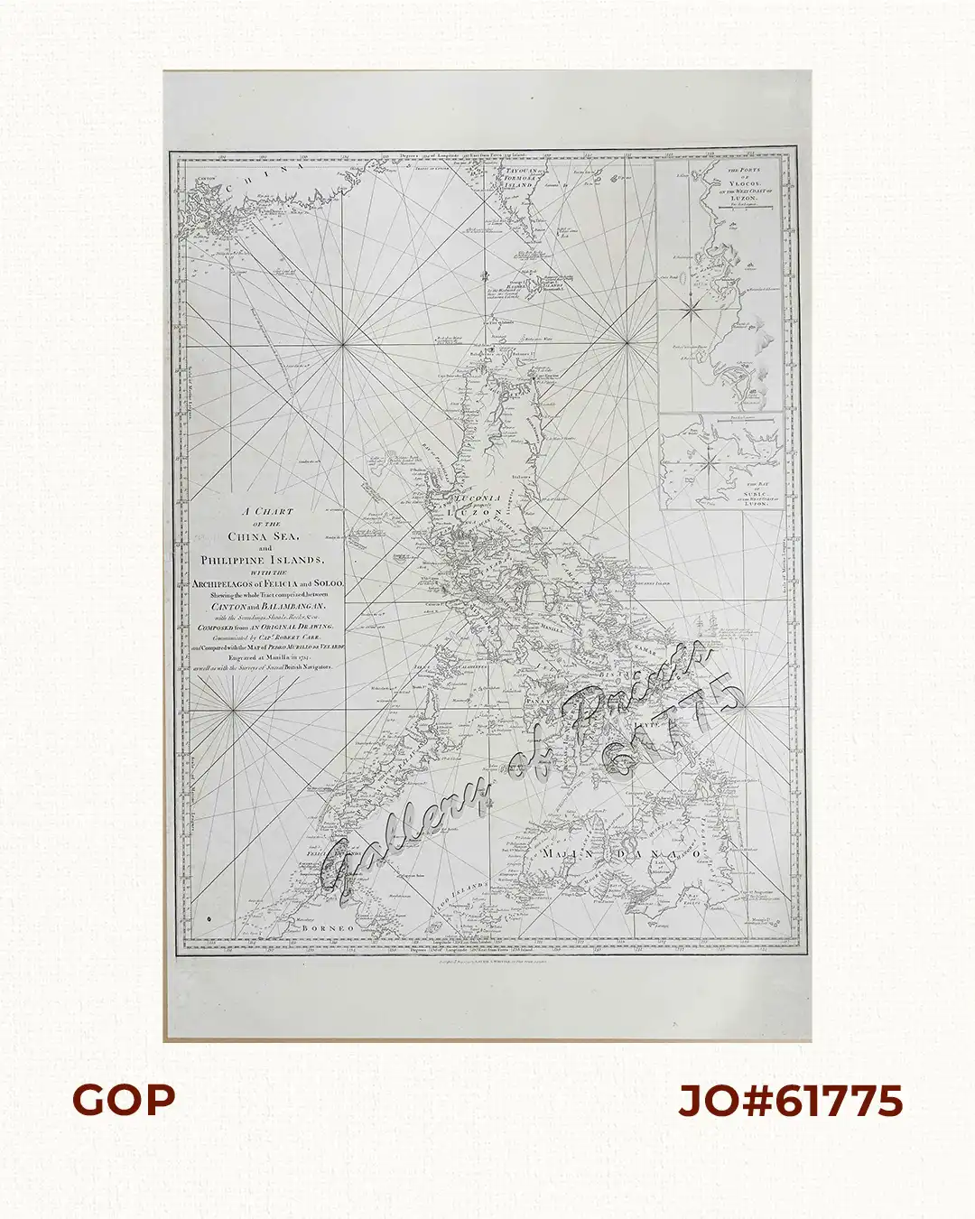
Glorious sea chart from “The Complete East-India Pilot, or Oriental Navigator”, vol. II, no. 109, printed and published by Robert Laurie and James Whittle in London with many interesting features, including not one but two treasure ships: An Acapulco – Manila Galleon and an East India ship of the British.
New Edition in two large volumes “neatly engraved on 132 plates …and corrected to the present year”.
The DEFINITIVE collector’s Treasure Map, one of the rarest and the largest map with attribution to Murillo in the 18th Century.
A complete background text is available upon request by interested buyer.
![Isla de Luzon pl. 10, inset: Pto. de Banacalan [Marinduque] (Quezon [or Tayabas], Camarines Norte, Marinduque, Balegin [Balesin], Calbalete [Cagbalete]… )](https://www.gop.com.ph/wp-content/uploads/2023/08/JO64134-Algue-1900-Isla-de-Luzon-scaled-1-600x750.webp)