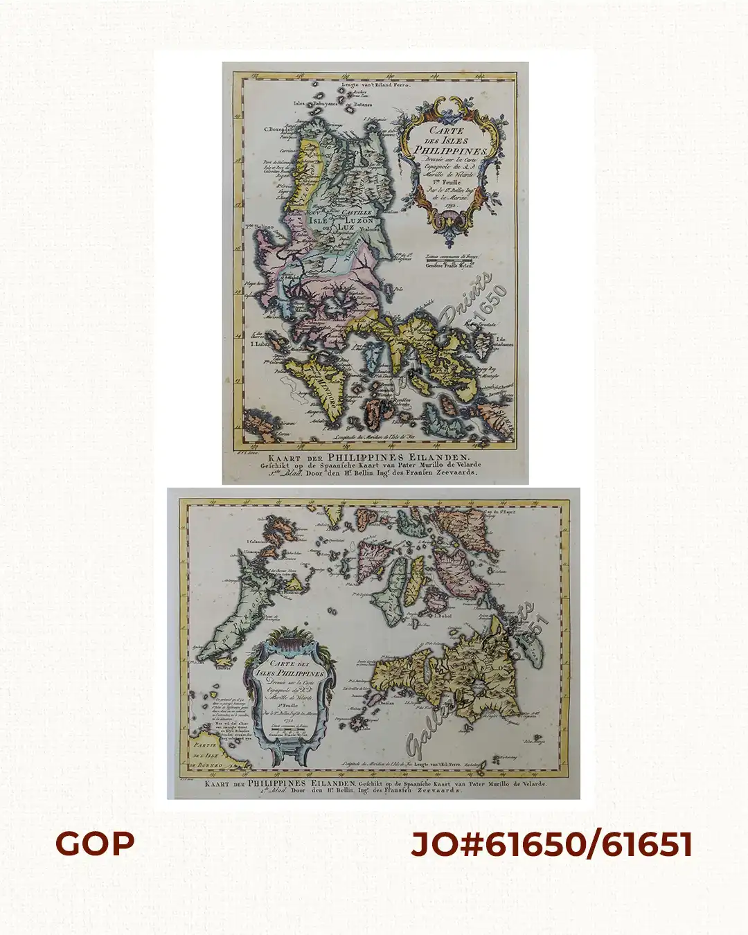
1) Carte des Isles Philippines (1e feuille) Kaart der Philippines Eilanden, Geschikt op de Spaansche Kaart van Pater Murillo de Velarde 1.ste Blad. Door den Hr. Bellin Ingr. des Fransen Zeevaards. 2) Carte des Isles Philippines (2e feuille) Kaart der Philippines Eilanden, Geschikt op de Spaansche Kaart van Pater Murillo de Velarde 2.de Blad. Door den Hr. Bellin Ingr. des Fransen Zeevaards.

77,000.00

In Stock

In Stock

Author: Jacques Nicolas Bellin / J.Y. S[chley] [engr.] / Abbe Antoine François Prevost d'Exile / I.V.S. direx

Publisher: Pieter de Hondt & J. Roman in Amsterdam.

Year: 1752

Size: 1) 21 x 15.7 cm, 2) 20.5 x 30 cm

Reference: Quirino, p.91

Description

Stunningly copper-engraved pair of the RARE Dutch edition of Bellin’s French maps of Northern and Southern PhilippPublished in ‘Historische Beschryving de Reizen …’, the Dutch edition of the Prevost Voyages “Histoire générale des voyages”, published first in Paris, 1746. the Dutch caption credits Murillo who created the ‘Mother of all Philippine Maps’. Nicolas Bellin (1703-1772) was one of the most important and proficient French cartographers of the mid-eighteenth century. He was appointed the first Ingenieur Hydrographe de la Marine, and also Official Hydrographer to the French king. Bellin produced a substantial number of important separately issued maps, particularly reflecting continuing discoveries and political events in the Americas.

Condition

hand-coloured copper engraving, excellent condition.

Shopping Cart
There are no products in the cart!
Continue Shopping
0