![[untitled] Terza Tavola [India Orientalis] [plate 3] [untitled]](https://www.gop.com.ph/wp-content/uploads/2023/08/JO60333-Ramusio-Terza-Tavola-1563-scaled-1.webp)
Description
copper engraving. EXTREMELY RARE.
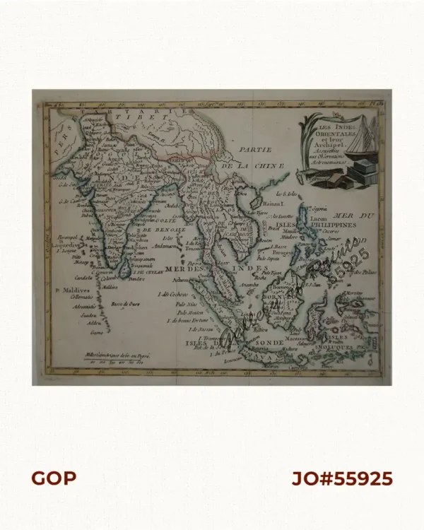
The most important map for the Philippines, named as its Birth Certificate, in vol. 1 of the 3-volume travel collection “Delle navigationi et viaggi” [Navigations and Travels] accompanying the chapter “Epistola di Maximiliano Transilvano”; the first copper plate edition, overall the 2nd edition; published by Lucantonio Giunti with Ramusio in Venice; map is oriented in the opposite, i.e. S-N. This is the first Western map showing and naming the Philippines: ‘Filipina’. (Munster’s 1554, 1st ed. states “Palaoan” only or Santa Cruz 1542 names Polagua & Madenao, plus others in 1545.) The 1st edition = wood-cut stock burnt at Tommaso Giunti’s in 1557; subsequent editions generally include the new copper plate as here. Unlike on the wood block, the town “Chiamay” in the “Lago di Chiamay” is not present on this copper plate edition. This map was particularly significant as Gastaldi used not only Pigafetta’s account of Magellan’s journey, but it also benefited from new sources, including Juan Gaytan and Villalobos’ journey from Mexico to the Philippines. This is the most easterly of a set of three maps, extending from the Bay of Bengal, to the eastern coasts of China, with Japan “Cympagu” as a single island at the extreme left. The coastlines of the Malay peninsula, Indochina and southern China, including Canton and Marco Polo’s Zaiton are extensively denoted.
Suarez notes that Ramusio’s update of the region is a great advance from the 1548 Gastaldi map, relying upon Portugese charts and the works of Joao de Barros as principal sources for the updates.
The Spanish expedition leader Ruy Lopez de Villalobos bestowed the name Felipina on Leyte in honor of the young Crown Prince Philip (later Philip II) in 1543. The map first appeared in the second edition of Volume I in 1554.
Giovanni Battista Ramusio (1485-1557) was an Italian geographer who served as a civil servant within the Venetian Empire throughout Europe, allowing him to build up a network of informants and a collection of travel materials – unrivalled in the 16th Century.


![Cocos Nucifera. - Linn. - Blanco. [Local Name: Coconut]](https://www.gop.com.ph/wp-content/uploads/2018/11/jo61825-Blanco-1880-1883-Cocos-Nucifera-600x750.webp)