Phone: +63 2 7729 8168 | Mobile: +63 917 806 4291

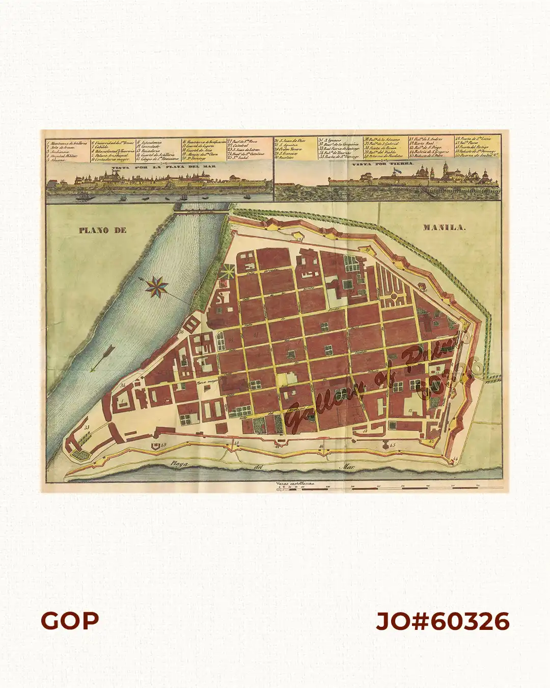
Plano de Manila (inset: 1. Vista por la Playa del Mar, 2. Vista por Tierra)

88,000.00

Author: Buzeta, Fr. Manuel / Bravo, F.

Publisher: Colegio de Valladolid and José C. de la Pena , Madrid.

Year: 1851

Size: 24.5 x 32 cm, inset 1: 4.7 x 16.2 cm, inset 2: 4.7 x 16.2 cm

Reference: Quirino p.111; Phillips, Maps in Lib Con #189

1 in stock

SKU: 60326 Category: Tags: ,

Description

hand-coloured lithograph.

A very desirable map for any collector of Manila prints from Diccionario Geografico-Estadistico-Historico de las Islas Filipinas.
Produced by the Augustinian friars and scholars Fr. Manuel Buzeta and Fr. Felipe Bravo, this detailed plan ranks among the most important printed maps of 19th-century Manila. It depicts the colonial capital at the height of Spanish rule, recording the fortified city of Intramuros, its suburbs, roads, waterways, churches and public buildings.

Condition

professionally repaired tear on left margin, with folds as issued.

Shopping cart0
There are no products in the cart!
Continue shopping
0