Phone: +63 2 7729 8168 | Mobile: +63 917 806 4291

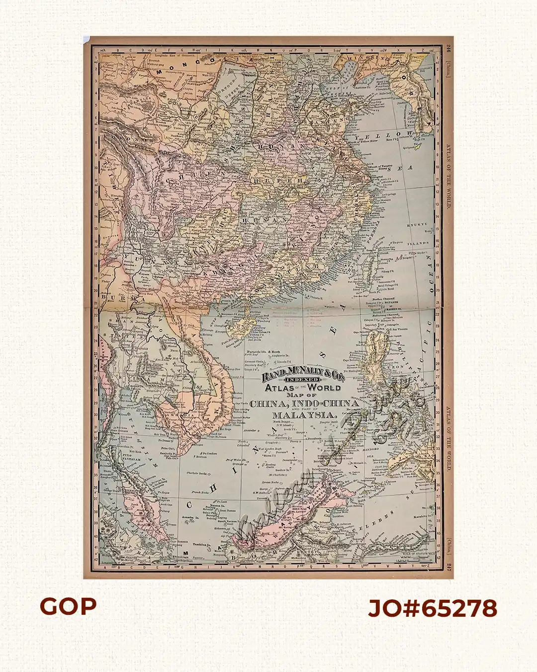
Rand, McNally & Co’s Indexed Atlas of the World Map of China, Indo-China and part of Malaysia.

6,600.00

Author: Rand, McNally & Co.

Publisher: Rand, McNally & Co. Publishers, Chicago and New York, U.S.A.

Year: 1894

Size: 50.1 x 32.6 cm [image], 53 x 35.6 cm [paper]

Reference: Not in Quirino; not in Phillips

1 in stock

Description

Original-colour lithograph map from the “Atlas of the World”, pp. 246-247;

The map names many of the islands, shoals, and reefs in the China Sea/West Philippine Sea but crops East Mindanao. verso: British India. (partial) with inset of Indo China and Farther India, p. 245, & Oceania., p. 248.2 sheets joined; light paper toning, minor material loss on margins, brittle edges. Otherwise in excellent condition.

Condition

2 sheets joined; light paper toning, minor material loss on margins, brittle edges. Otherwise in excellent condition.
Shopping cart0
There are no products in the cart!
Continue shopping
0