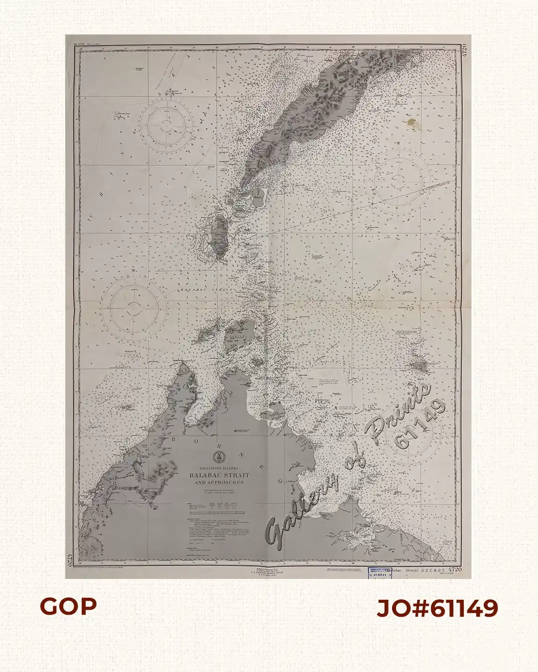
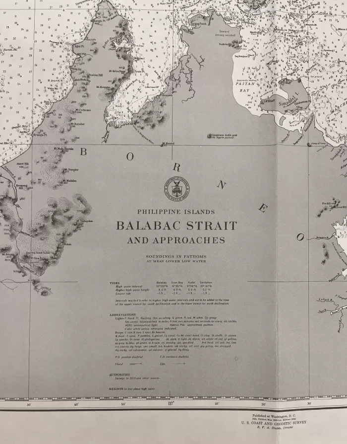
Description
RARE lithograph map #4720, seachart published at Washington, D.C 8th. Edition May 1936- 1st. Edition 1904 by the U.S. Coast and Geodetic Survey, R. F. A. Studds, Director.
Corrected through Notice to Mariners No. 52 Dec 29 1951, U.S Navy Hydrographic Office.
with “36-5/9, 41-3/6; 42-2/12; 43-9/11; 44-6/15, 11-9; 45-7/14, 10/13; 49-5/23; 50-9/11; 51-6/11”

![Islas de Infanta y Polillo pl. 12 [Quezon Prov., Polilio Is., Pananongan I., Jomalig I.]](https://www.gop.com.ph/wp-content/uploads/2023/08/JO62585-Algue-1900-Quezon-Province-Polilo-Jomalig-Patnanongan-scaled-1-600x750.webp)